


LEWIS, Clay County, Indiana
About
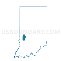
Outline

Summary
| Unique Area Identifier | 576650 |
| Name | LEWIS |
| County | Clay County |
| State | Indiana |
| Area (square miles) | 44.22 |
| Land Area (square miles) | 44.05 |
| Water Area (square miles) | 0.17 |
| % of Land Area | 99.62 |
| % of Water Area | 0.38 |
| Latitude of the Internal Point | 39.22243530 |
| Longtitude of the Internal Point | -87.18935770 |
Maps


Graphs
Select a template below for downloading or customizing gragh for LEWIS, Clay County, Indiana


Neighbors
Neighoring Voting District (by Name) Neighboring Voting District on the Map
- HARRISON 01, Clay County, IN
- HARRISON 02, Clay County, IN
- JACKSON 1, Sullivan County, IN
- JACKSON 2, Sullivan County, IN
- PERRY, Clay County, IN
- PIERSON- A, Vigo County, IN
- SMITH, Greene County, IN
- WRIGHT 01, Greene County, IN
- WRIGHT 04, Greene County, IN
Top 10 Neighboring County Subdivision (by Population) Neighboring County Subdivision on the Map
- Wright township, Greene County, IN (3,921)
- Harrison township, Clay County, IN (2,172)
- Jackson township, Sullivan County, IN (1,904)
- Lewis township, Clay County, IN (1,464)
- Pierson township, Vigo County, IN (1,210)
- Perry township, Clay County, IN (934)
- Smith township, Greene County, IN (383)
Top 10 Neighboring Place (by Population) Neighboring Place on the Map
Top 10 Neighboring Unified School District (by Population) Neighboring Unified School District on the Map
- Vigo County School Corporation, IN (107,848)
- Clay Community Schools, IN (26,163)
- Northeast School Corporation, IN (8,687)
- White River Valley School District, IN (5,783)
- Shakamak Schools Metropolitan School District, IN (5,385)
Top 10 Neighboring State Legislative District Lower Chamber (by Population) Neighboring State Legislative District Lower Chamber on the Map
Top 10 Neighboring State Legislative District Upper Chamber (by Population) Neighboring State Legislative District Upper Chamber on the Map
Top 10 Neighboring 111th Congressional District (by Population) Neighboring 111th Congressional District on the Map
Top 10 Neighboring Census Tract (by Population) Neighboring Census Tract on the Map
- Census Tract 501, Sullivan County, IN (6,005)
- Census Tract 107.02, Vigo County, IN (5,693)
- Census Tract 9549, Greene County, IN (5,075)
- Census Tract 406, Clay County, IN (3,653)
- Census Tract 405, Clay County, IN (3,555)
- Census Tract 9550, Greene County, IN (3,038)
Top 10 Neighboring 5-Digit ZIP Code Tabulation Area (by Population) Neighboring 5-Digit ZIP Code Tabulation Area on the Map
- 47802, IN (34,532)
- 47438, IN (4,798)
- 47879, IN (3,302)
- 47471, IN (2,727)
- 47841, IN (2,138)
- 47427, IN (1,093)
- 47858, IN (698)